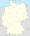
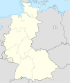
Файл:Germany location map 8 Jun 1947 - 22 Apr 1949.svg

Подув файл (SVG файл, номинальнӧя 1075 × 1273 пиксель, файл ыджда: 1,12 МБ)
Тайӧ файлыс на Викискладе-ысь, сійӧн позьӧ вӧдитчыны мукӧд проектын. гижӧда лист бокысь юӧрыс вайӧдӧма улынджык.
Ставнас
| ГӧгӧрвоӧдӧмGermany location map 8 Jun 1947 - 22 Apr 1949.svg |
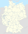
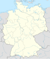
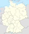
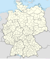
Deutsch: Positionskarte (West- und Mittel-) Deutschlands. Diese Karte zeigt den Gebietsstand zwischen 8. Juni 1947 bis 22. April 1949.
Quadratische Plattkarte, N-S-Streckung 150 %. Geographische Begrenzung der Karte:
English: Location map of Germany. The map shows Germany as it was between June 8, 1947 and April 22, 1949.
Equirectangular projection, N/S stretching 150%. Geographic limits of the map:
|
||
| Кадпас | Created in 2010 | ||
| Ӧшмӧс |
own work, based on: |
||
| Автор | TUBS | ||
| Лэдзӧм (Тайӧ файлӧн выльысь вӧдитчӧм) |
Я, владелец авторских прав на это произведение, добровольно публикую его на условиях следующих лицензий:
Тайӧ файлнас позьӧ вӧдитчыны Creative Commons Attribution-Share Alike 3.0 Unported лицензия серти.
Ті верманныд бӧрйыны лицензиясӧ ас кӧсйӧм серти. |
||
| Другие версии |
 English Labeled version Bundesrepublik Deutschland (vor 1990 nur West-Deutschland):
Deutsche Demokratische Republik (mit BRD im Ausschnitt):
Ostdeutschland (vor 1990 Deutsche Demokratische Republik):
Deutschland zwischen Mai 1945 und Oktober 1949:
Thematisch:
Deutsches Reich (1918–1945) (best used with this template (de)):
|
| Annotations InfoField | This image is annotated: View the annotations at Commons |
Kehl
Краткие подписи
Элементы, изображённые на этом файле
изображённый объект русский
создатель русский
У этого свойства есть некоторое значение без элемента в
правовой статус русский
защищено авторским правом русский
Файл история
Личкы кадпас/кад, медым аддзыны файллысь сэкся версия.
| Кадпас/Кад | Миниатюра | Ыджда | Вӧлысь | Пасйӧд | |
|---|---|---|---|---|---|
| ӧнія | 08:25, 30 косму 2010 |  | 1075 × 1273 (1,12 МБ) | TUBS | == {{int:filedesc}} == {{Information |Description= {{de|Positionskarte (West- und Mittel-) Deutschlands. Diese Karte zeigt den Gebietsstand zwischen 8. Juni 1947 bis 22. April 1949.}} Quadratische Plattkarte, N-S-Streckung 150 %. Geogr |
Ыстӧдъяс
Тайӧ файлӧн вӧдитчысь лист бокъяс абуӧсь.
Файлнас глобальнӧя вӧдитчӧм
Тайӧ файлӧн вӧдитчӧны мукӧд викиын:
- Вӧдитчӧны de.wikipedia.org-ын
- Вӧдитчӧны en.wikipedia.org-ын


